The following demonstration showcases a map created with “Progress Map”, featuring all available addons/extensions that are installed and activated. To modify the map settings, navigate to this settings page!


 Filters


Directions
Get directions between your address/position and any location on the map. Show locations within a specific distance of your location/address. Display routes and the directions steps.
Choose a starting point
Enter an address or

geolocate your position.
1.
Click to activate/deactivate the distance search.
2. (When activated) Use the slider to define the size of the search area.
3. Click on the button

to search.


Switch the travel mode.


Click on the marker popup to render the route and the directions steps.
 Directions
Click to toggle the directions steps widget.

Click to hide the directions steps widget.
Click to remove the currently displayed route and the directions steps widget.

Click to reverse the start point and the destination. This will update the route and the directions steps.

Click to center the map on your starting point.
Reset
Click to reset and search from scratch.

 Add Area
 Edit Area
 Delete Area

Search 
Draw from scratch
History
Draw a Map Search
Find locations in the exact area and streets you want to search in by drawing a polygon around your desired area. Once drawn, the map will display all available locations within the drawn area. You can also draw additional areas and/or edit the existing ones.
Add Area
Click to start drawing a search area. To draw, click and hold on the map, then move the cursor around the desired zone.
Cancel Add
Click to cancel adding areas.
Edit Area
Click to edit area(s). The areas will change color to yellow. To edit an area, click and drag a vertex/point to a new location.
You can also remove vertices/points by double-clicking on them. Once you've finished editing the area(s), click the "Search" button.

Click & Drag a vertex/point to move it, or Double click to remove it.
Cancel Edit
Click to cancel editing areas.
Search
Once finished editing area(s) Click to search again.
Delete Area
Click to delete area(s). When the area turns red, click on it to delete.
Cancel Edit
Click to cancel deleting areas.
Click to display the history of all drawn areas, including the previously deleted ones.
Area ? (? item)
Click to display area info (Boundaries length & Surface area).
Edit
Click to edit the area.
Delete
Click to delete the area.
Restore
Click to restore the area.
Permanently Delete
Click and confirm to permanently delete the area.
Draw from scratch
Click and confirm to permanently delete all areas and to start a new search.
Submit location

38 Result(s)


 Default
- Date (Newest first)
- Date (Oldest first)
- Title A to Z
- Title Z to A
- Default
- Rating (Highest first)
- Rating (Lowest first)
- Population (Highest first)
- Population (Lowest first)
 Refine Search
Loading

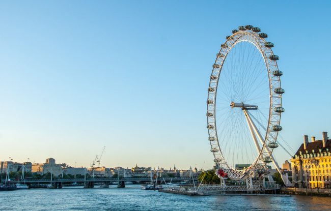

The London Eye, or the Millennium Wheel, is a cantilevered observation wheel on the South Bank of the River Thames in London. It is Europe’s tallest c…
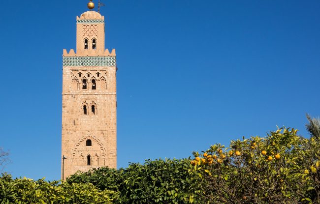
The Kutubiyya Mosque or Koutoubia Mosque is the largest mosque in Marrakesh, Morocco. The mosque’s name is also variably rendered as Jami’ al-Kutubiya…
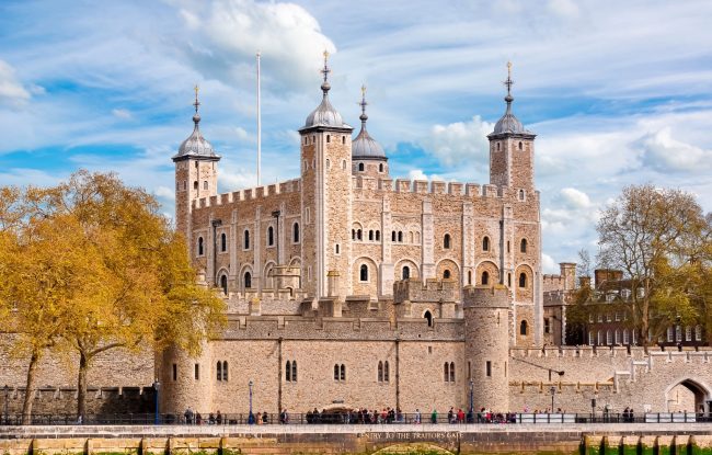
The Tower of London, officially Her Majesty’s Royal Palace and Fortress of the Tower of London, is a historic castle located on the north bank of the …
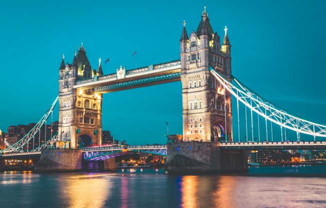
Tower Bridge is a combined bascule and suspension bridge in London, built between 1886 and 1894. The bridge crosses the River Thames close to the Towe…
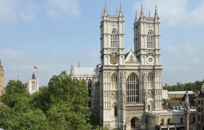
Westminster Abbey, formally titled the Collegiate Church of Saint Peter at Westminster, is a large, mainly Gothic abbey church in the City of Westmins…
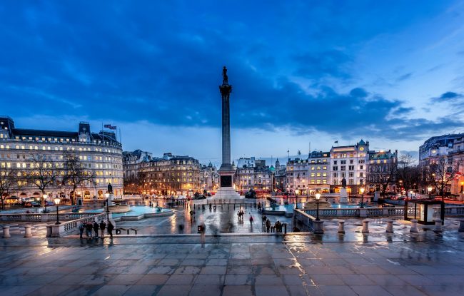
Trafalgar Square is a public square in the City of Westminster, Central London, built around the area formerly known as Charing Cross. Its name commem…
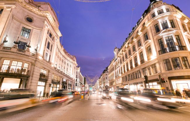
Oxford Street is a major road in the City of Westminster in the West End of London, running from Tottenham Court Road to Marble Arch via Oxford Circus…
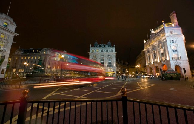
Piccadilly Circus is a road junction and public space of London’s West End in the City of Westminster. It was built in 1819 to connect Regent Street w…
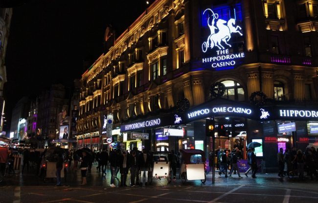
4-floor casino & cabaret…

